യൂണിവേഴ്സിറ്റി ഹോം ഡിപ്പാർട്ട്മെന്റുകൾ സെന്ററുകൾ പ്രസിദ്ധീകരണങ്ങൾ
Accessibility
Contrast
Increase Font
Decrease Font

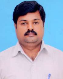
Dr. Thangavelu A

Dr. Thangavelu A

  9994425111

  thangavelgis@gmail.com

Qualifications :   Ph.D

Areas of Current Research Interest:

  • Remote Sensing & Geographical Information System
  • Ground Water Quality Assessment and Modelling
  • Snow and Avalanche modelling (Climate change)
  • Watershed & Hydrological modelling
  • Solid Waste Management, EIA & Environment and Sustainability
  • Crime & Statistical modeling
  • Data Mining & Association Rules with Fuzzy Logic Techniques.

Assistant Professor (On contract basis): July 22, 2019 - till Continuing Department of Environmental Studies. Kannur University, Mangattuparamba Campus.

Subjects for teaching: Environmental Science & Engineering, Ecology and Environment, Biostatistics, Remote Sensing and Geographic Information system, Climate Change, Hydrology and Water resource Engineering, Environmental Economics, Environmental Impact Assessment, Biodiversity etc.

Under guidance UG and PG students project - 26

International Journals:

  • Sapna, K., Thangavelu, A*., Sujithra B (2020) “GIS based evaluation of contamination of fluoride in groundwater quality and occurrence of dental fluorosis in Coimbatore district, TamilNadu, India” in IOP Conference Series: Materials Science and Engineering.
  • Sapna, K., Thangavelu, A*., Kaarmuhil (2020) “Surveillance of groundwater quality of selected rural and industrial areas of Coimbatore: A GIS Approach” in IOP Conference Series: Materials Science and Engineering.
  • Thangavelu, A*., Sapna, K., Sathyaraj, S.R and Balasubramanian, S (2020) “Spatial Temporal Analysis of rural crime hot spot zone using GIS: A part of Coimbatore”, in American Journal of Geographical Research and Reviews, 3:15.
  • Thangavelu A*, Dewali S K, Snehmani and Ganju A (2019), “Integration of terrain and AVHRR derived multi-temporal snow cover data for statistical assessment of avalanches: Case study of a part of NW Himalaya”, Arabian Journal of Geosciences, DOI: 10.1007/s12517-019-4691-7.
  • Thangavelu, A*., Sapna, K and Prabitha R, (2019) “Assessment of Fluoride Hazard in Groundwater of Palghat District, Kerala: A GIS Approach” in International Journal of Environmental Pollution. DOI: 13.1028/p14218-017-4761-8.
  • Sapna, K ., Thangavelu, A* ., Mithran, S and  Shanthi, K (2018) “Spatial Analysis of River water quality using Inverse Distance Weighted Interpolation in Noyyal Watershed in Coimbatore, Tamilnadu, India”, in Research Journal of Life Sciences, Bioinformatics, Pharmaceutical and Chemical Sciences, 2018 Jan - Feb RJLBPCS 4(1) Page No.150.
  • Thangavelu, A*., Sathyaraj, S.R and Balasubramanian, S (2013) “Assessment of Spatial Distribution of Rural Crime Mapping In India: A GIS Perspective”, in International Journal of Advanced Remote Sensing and GIS, Volume 2, Issue 1, PP 69-84.
  • Thangavelu, A* (2013) “Mapping the groundwater quality in Coimbatore city, India based on Physico-chemical parameters” in International Journal of Environmental Science, Toxicology and Food Technology,  Volume 3, Issue 4, PP 32-40.
  • Thangavelu, A., Sathyaraj, S.R., Syed Firdose, Krishnakeerthi, Ch and Balasubramanian, S (2012) “Clustered spatial data mining association rule to explore large volumes of rural crime” in International Journal of Computer Science and Management Studies, Volume 12, Issue 3, PP 134-142.
  • Thangavelu, A*., Sathyaraj, S.R., Sridhar, R and  Balasubramanian,  S.,  (2012) “Area Based Crime Analysis in Spatial Data Mining Approach for Association Rule in Geo-Referenced Data” in International Journal of Data mining and Knowledge Engineering, Volume 4, No 2, PP 59 - 63.
  • Thangavelu, A* ., Sathyaraj, S.R., Sridhar, R and Balasubramanian,  S (2012) Fuzzy Logic Association Rules Integrating with Matlab for Effective Policing in Crime Analysis” published in International Journal of Fuzzy Systems, Volume 4,     No 1, PP 23 –29.
  • Thangavelu, A*., Sathyaraj, S.R, Sridhar, R and  Balasubramanian,  S (2012) “Association Rule - Spatial Data Mining Approach for Geo-Referenced in Crime to Crime Analysis” in International Journal of Data Mining Knowledge Engineering, Volume 4, No 1, PP 31–36.


Book:

A Text Book of Environmental Science: Thangavelu Arumugam* and Sapna K (2020) in Walnut Publication.

Book Chapter:

Crime in Rural Area: A GIS Perspective/ Thangavelu, A*., Sathyaraj, S. R., Balasubramanian, S., Sridhar, R., Chandran, M and Prashanthi Devi, M (2012) in book: Crime and Criminal Justice in Asia xxii, 469 p. ills. Maps. 22 cm.1st ed. New Delhi, Mittal Publications.


International Conferences:

  • Sapna, K., Thangavelu, A., Sujithra B (2020) “GIS based evaluation of contamination of fluoride in groundwater quality and occurrence of dental fluorosis in Coimbatore district, TamilNadu, India” in First International Conference on Sustainable Infrastructure with Smart Technology for Energy and Environmental Management (FIC-SISTEEM-2020) September 03-04, 2020, Organized by Department of Civil Engineering, Bannari Amman Institute of Technology Sathyamangalam, TamilNadu.
  • Sapna, K., Thangavelu, A., Kaarmuhil SP (2020) “Surveillance of groundwater quality of selected rural and industrial areas of Coimbatore: A GIS Approach” in in First International Conference on Sustainable Infrastructure with Smart Technology for Energy and Environmental Management (FIC-SISTEEM-2020) September 03-04, 2020, Organized by Department of Civil Engineering, Bannari Amman Institute of Technology Sathyamangalam, TamilNadu.
  • Thangavelu A, Sapna K, Sujisha K (2020) “Surveillance of Groundwater Quality Using Geospatial Interpolation Technique in Kasaragod District, Kerala”, International Conference on Triple Helix Ecosystem for Earth, Environment and Energy THE3E 2020 18th - 19th MARCH, 2020, Organized by Department of Civil Engineering, PSG Institute of Technology and Applied Research Neelambur, Coimbatore In association with Glasgow Caledonian University, Scotland & Deakin University, Australia.
  • Thangavelu A, Sapna K, Praveen K (2020), “Spatial distribution of Groundwater Quality Using GIS: A Case study of Kannur District, Kerala”, International Conference on Triple Helix Ecosystem for Earth, Environment and Energy THE3E 2020 18th - 19th March, 2020, Organized by Department of Civil Engineering PSG Institute of Technology and Applied Research Neelambur, Coimbatore In association with Glasgow Caledonian University, Scotland & Deakin University, Australia, ISBN: 978-93-89515-17-6.
  • Thangavelu, A., Sathyaraj, S.R and Balasubramanian, S (2012) “Spatial distribution of crime in Coimbatore rural Area: A GIS Analysis” Second International Conference of the “South Asian Society of Criminology and Victimology” (SASCV), January 11 - 13, 2013, Kanyakumari, Tamilnadu, India.
  • Sathyaraj, S.R., Thangavelu, A and Balasubramanian, S (2012) “GIS Analysis of Spatially referenced Auto Vehicle Theft Crime in Coimbatore Urban, India: Visualization through Kernel Estimation India” International Cartographic Association 3rd International Conference on Cartography and GIS, June 15 - 20, 2010, Nessebar, Bulgaria.
  • Sathyaraj, S.R ., Thangavelu, A  and  Balasubramanian,  S (2010) “Association Rule–spatial Data Mining Approach for Exploration of Large Volumes of Geo-referenced Risk Prone Crime to Crime Data” International Cartographic Association 3rd International Conference on Cartography and GIS, June 15 - 20, 2010, Nessebar, Bulgaria.


National Conferences:

  • Thangavelu, A., Sathyaraj, S.R and Balasubramanian, S (2012), “Visualization of Groundwater Quality Modelling in Physico-chemical Parameters Using GIS” Regional Science Congress on “Agricultural and Forestry Sciences/Plant Sciences/Environmental Sciences” in during December 15 -16, 2012 conduct on Kongunadu Arts and Science College (Autonomous), Coimbatore.
  • Thangavelu, A., Sathyaraj, S.R and Balasubramanian, S (2012), “Spatial Distribution of Crime Analysis in Coimbatore Police Division, Using GIS”, Regional Science Congress on “Anthropological and Behavioural Sciences” in during December 15 -16, 2012, conduct on Kongunadu Arts and Science College (Autonomous), Coimbatore.
  • Thangavelu, A (2011) “Distribution of Select Nutrient Element in Coimbatore Wetland Sediments” sponsored by Ministry of Earth Sciences, Govt of India,  New Delhi on  “Climate change and its impacts on life and water resources” during July 22 - 23, 2011 ,  conduct on Humanities & Basic Sciences, Annamacharya Institute of Technology & Sciences, Hyderabad.
  • Sathyaraj, S.R., Thangavelu, A., Sridhar, R and Balasubramanian, S (2010), “Mining Fuzzy Association Rule Integrating with Matlab in Crime Data for Effective Patrol System of Coimbatore City in Tamilnadu, India” on December 8 -11, 2010, 2nd Annual Asian Society in Madras University, Chennai.
  • Thangavelu, A., Sathyaraj, S.R., Sridhar, R and Balasubramanian, S (2010), “Assessment of Crime Alarm Risk Prone Area Based on Using Spatial Point Pattern Analysis in Coimbatore Rural Police Division of Tamilnadu, India Using GIS” on December 8 -11, 2010,  2nd Annual Asian Society in Madras University, Chennai.
  • Sathyaraj, S.R., Thangavelu, A., Sathyaseelan, S and Balasubramanian, S (2010) “Estimation of Vehicular Pollution Effects in Coimbatore Using GIS Techniques’’ on  February 21 – 26, 2010,  GEOmatic Based Natural Resources Disaster Mitigation and Managements, Tamil University, Thanjavur
  • Thangavelu, A., Sathyaraj, S.R and Balasubramanian, S (2010), “Modeling of Groundwater Quality Using GIS Technique” on February 21-26, 2010, GEOmatic Based Natural Resources Disaster Mitigation and Managements, Tamil University, Thanjavur.
  • Sathyaraj, S.R., Geethalakshmi,V.,  Lakshmanan , A., Srinivasan, R.,  Thangavelu, A and Balasubramanian, S (2010), “Application of SWAT Model Integration with ArcGIS for Assessing in Bhavani Sub-Basin of Tamilnadu, India” on  February 21- 26, 2010,  GEOmatic Based Natural Resources Disaster Mitigation and Managements, Tamil University, Thanjavur.
  • Sathyaraj, S.R., Geethalakshmi, K., Lakshmanan, A., Srinivasan, R., Thangavelu, A  and Balasubramanian,  S (2010),  “Application of SWAT Model Integration with ArcGIS for Assessing Hydrology Model in Cauvery Basin of Tamilnadu, India on  February 21-26, 2010,  GEOmatic Based Natural Resources Disaster Mitigation and Managements, Tamil University, Thanjavur.
  • Thangavelu, A., Hannah Sampath and  Sathyaraj, S.R (2008), “Topological Evaluation of Soil and Land for Effective Land Use in Kallar Sub-Watershed, Niligiris Hills, Tamilnadu Using GIS” on March 27 - 28, 2008,  “Water and Mineral Resources Information’s and Environmental Impacts Analysis Using High Resolution satellite Imageries in the 21st Century”.  
  • Sathyaraj, S.R., Hannah Sampath and  Thangavelu, A (2008), “Land Use Assessment and Change Detection Analysis of the Kallar Sub-Watershed, Niligiris Hills, Tamilnadu Using GIS” on March 27 - 28, 2008, “Water and Mineral Resources Information’s and Environmental Impacts Analysis Using High Resolution Satellite Imageries in the 21st Century”.